Forecasters say Hilary could produce ‘potentially catastrophic’ flooding across San Diego County this weekend
Poway, Escondido and Lakeside could get hit by winds blowing 35 mph to 45 mph
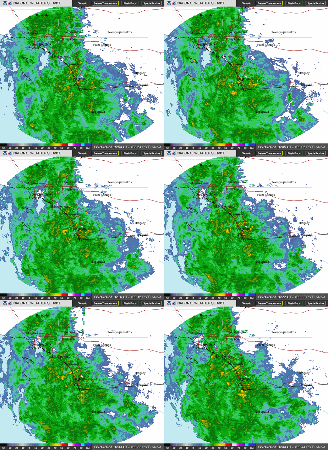
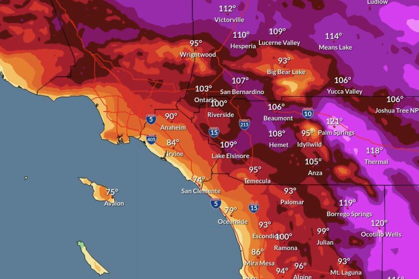
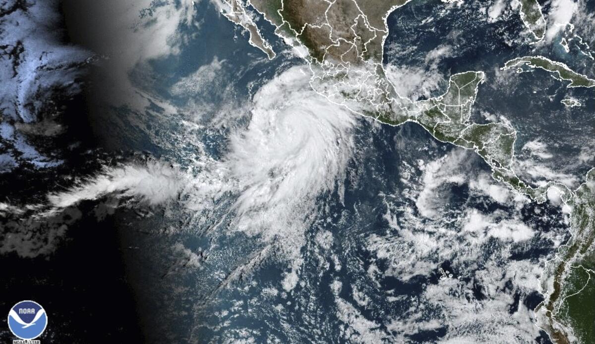
San Diego County will be under a tropical storm warning for the first time in history this weekend due to Hilary, a breathtaking cyclone that will produce “potentially catastrophic” flooding locally and in other parts of the southwestern U.S., the National Hurricane Center said Friday.
The advisory was changed from a watch to a warning Friday night, and contributed to the Navy’s decision to send many of its active-ready San Diego-based warships to sea for several days to make it easier to manage and protect vessels in port that are undergoing maintenance.
Update:
9:54 a.m. Aug. 18, 2023NWS warns that Hilary will pass within 100 miles of San Diego.
The statements came as the National Weather Service was getting highly specific, stating that the county will experience a volatile mix of extremely heavy rain, wild winds and booming surf that could trigger mudslides, knock out power, destroy roads and bite chunks out of beaches.
At the time, Hilary was spinning west of lower Baja California with sustained winds of 140 mph, making it a Category 4 hurricane. The system is expected to creep up the peninsula, weakening over cooler water and reverting back to a tropical storm.
But it will release a deluge. The weather service said Hilary will produce 2 to 3 inches of rain at the coast, 2 to 4 inches across inland valleys and 4 to 10 inches in the mountains and deserts, with some spots in those areas receiving as much as 1 foot of rain.
The city of Poway has three locations where residents can get empty sandbags and loose sand:
- West side of Midland Road, south of Old Poway Park (in the Farmer’s Market parking lot)
- South side of Garden Road, east of Floral Avenue (across from Garden Road School)
- Old Coach Road trailhead north of Butterfield Trail.
Bring a shovel to fill sandbags. Check the city’s Facebook and Twitter to get updates on availability.
The rain will begin on Saturday, but Hilary won’t reach its peak until late Sunday and early Monday. During that period, the wind will gust upwards of 40 mph in Escondido, Poway and Lakeside and many coastal areas, 50 mph or higher in places such as Alpine and Ramona, 64 to 67 mph in El Cajon, Campo and Mount Laguna. Gusts could reach 80 mph at Ocotillo Wells. Driving is expected to be treacherous on Interstate 8, near the border of San Diego and Imperial counties. Tornadoes could embed with rain cells in that area.
The surf will crest to 7 feet or higher north of Carlsbad, and the entire coastline will be raked by strong longshore currents and rip currents.
“These threats represent a life-threatening situation for San Diego and the rest of Southern California,” said John Suk, meteorologist-in-charge of the weather service office in Rancho Bernardo.
His colleague, Alex Tardy, said, “It does look like the eye-wall (of Hilary) will make it into San Diego County.”
The exact location matters. If Hilary continues on its current course, it will amplify rain in the county’s mountains and deserts. If the storm shifts east, there will be less rain here. But forecasters said Friday that a heat dome over Iowa and the central plains will prevent Hilary from sharply veering into northern Baja California.
UC San Diego re-positioned a wave buoy off Baja California Friday, hoping to get a good look at one of nature’s most violent phenomena.
The possibility of trouble caused a stir across San Diego County.
Emergency crews hustled to place “No parking” signs in low-lying and flood-risk areas of San Diego, including along the San Diego River, which could near flood stage in the Fashion Valley area over the weekend.
Workers also quickly moved to secure equipment at San Diego International Airport. So did General Dynamics-NASSCO, whose spokesperson, Brian Adams, said the shipyard “will be double-securing anything that can move.”
There was a mad dash for supplies at a Home Depot in Clairemont, which temporarily ran out of bags and sand. The Padres announced that they would hold a double-header at Petco Park on Saturday, instead of single games on Saturday and Sunday.
San Diego State University said that its main campus and satellite in Imperial Valley will transition to virtual instruction on Monday so students don’t have to drive in the storm. Cal State San Marcos said it “will be canceling or moving to virtual formats any in-person events scheduled for” Sunday and Monday.
Father Joe’s Villages in San Diego said it would offer temporary overnight shelter on Saturday and Sunday nights.
Police and fire agencies across the region were beefing up staffing as the storm barrels north. For San Diego Fire-Rescue Department, extra staffing starts Saturday, and peak staffing hits Sunday.
“We are preparing for impact both coastal and inland,” Fire-Rescue Assistant Chief David Gerboth said Friday, moments before he was to jump on a conference call with the National Weather Service.
In addition, San Diego County Fire Department, operated by Cal Fire, will have two dedicated swift-water rescue teams — one in the north, one in the south — ready to go.
“They are available for regional response. For any agency that needs assistance, county fire will provide it,” Cal Fire Capt. Mike Cornette said.
In Baja California, classes and non-essential public activities will be suspended from Saturday afternoon until Monday, and 80 shelters will be set up throughout the state, said Gov. Marina del Pilar Ávila.
Staff writers Pam Kragen, Teri Figueroa, George Varga, Lori Weisberg and Alexandra Mendoza contributed to this report.
Updates
9:54 a.m. Aug. 18, 2023: The story was updated with new projected rainfall totals.
6:08 p.m. Aug. 17, 2023: The story was updated with the latest forecast information.
Get the Pomerado News in your inbox weekly
Top headlines from Poway, Rancho Bernardo and 4S Ranch, every Thursday for free.
You may occasionally receive promotional content from the Pomerado News.


