Size of this preview: 800 × 415 pixels. Other resolutions: 320 × 166 pixels | 640 × 332 pixels | 1,024 × 532 pixels | 1,280 × 665 pixels | 2,560 × 1,329 pixels | 4,000 × 2,077 pixels.
Original file (4,000 × 2,077 pixels, file size: 5.47 MB, MIME type: image/jpeg)
| This is a file from the Wikimedia Commons. Information from its description page there is shown below. Commons is a freely licensed media file repository. You can help. |
Summary
| Description |
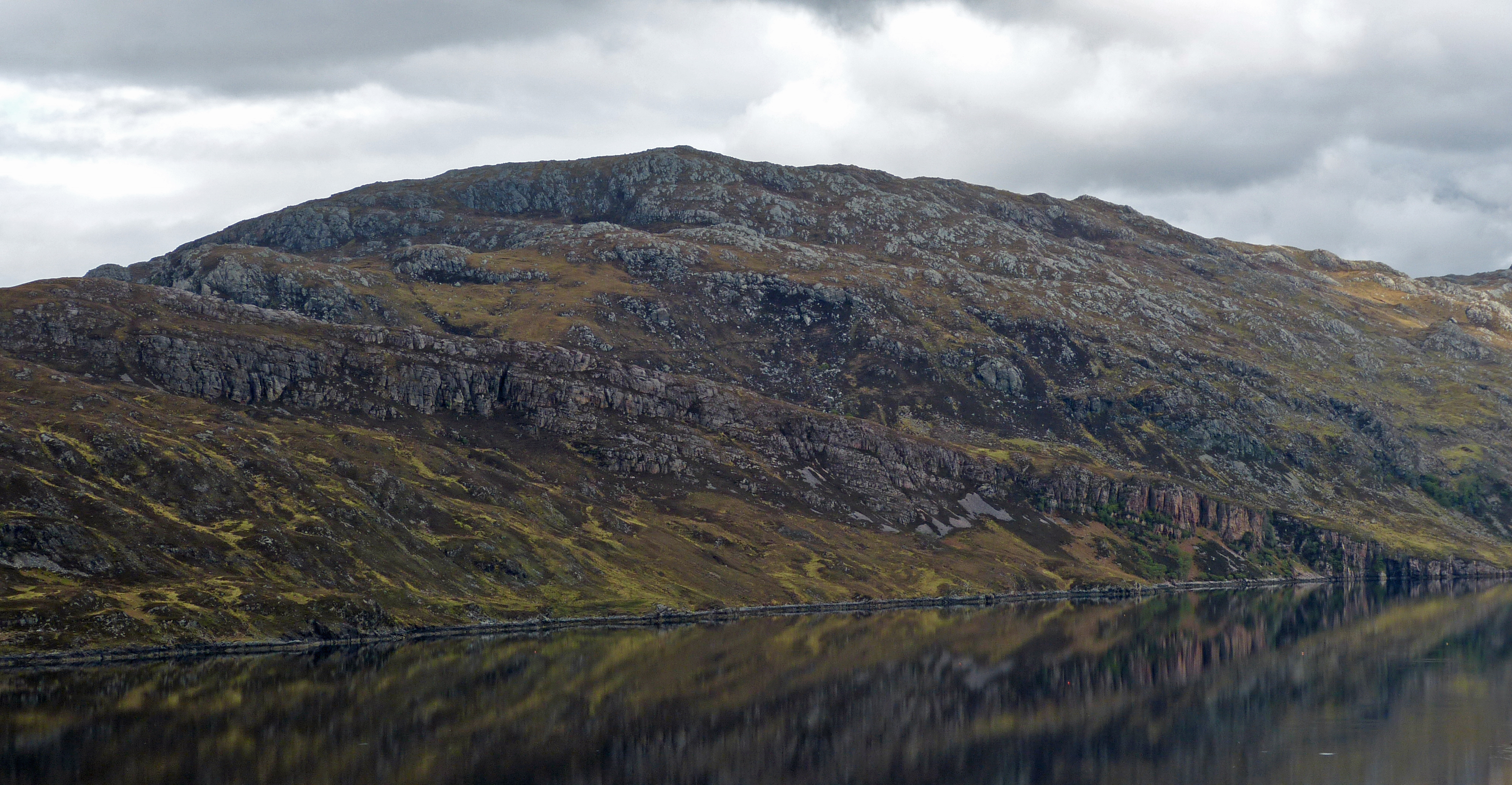
English: The Glencoul Thrust fault zone at Loch Glencoul near Kylesku in the Northern Highland of Scotland, Irish-Scottish Caledonides, viewed from the south-west. Precambrian gneiss has been pushed along the thrust fault and now lies above younger Cambrian quartzite (including the so-called pipe rock) and siltstone (Fucoid beds, outcrop hardly visible in the image due to viewing angle), which in turn are underlain by Precambrian gneiss, however not with tectonic but with unconformable stratigraphic contact.
Deutsch: Die Glencoul-Überschiebungszone am Loch Glencoul nahe Kylesku im Northern Highland von Schottland, Irisch-Schottische Kaledoniden, von Südwesten gesehen. Präkambrischer Gneis ist hier auf kambrische Quarzite (einschließlich dem sogenannten Pipe Rock, einer Art schottischem Pendant zum skandinavischen Skolithos-Quarzit) und Siltsteine („Fucoid Beds“, Ausbiss aufgrund des Blickwinkels kaum sichtbar) überschoben worden, die wiederum von Präkambrischem Gneis unterlagert werden, jedoch nicht mit tektonischem, sondern diskordantem stratigraphischem Kontakt. |
| Date | |
| Source | https://www.flickr.com/photos/arg_flickr/14365057502/ |
| Author | Andrew (ARG_Flickr on Flickr) https://www.flickr.com/people/arg_flickr/ |
| Camera location | | View this and other nearby images on: OpenStreetMap |
|---|
Licensing
| This image was originally posted to Flickr by ARG_Flickr at https://www.flickr.com/photos/38986305@N06/14365057502. It was reviewed on 19 January 2015 by FlickreviewR and was confirmed to be licensed under the terms of the cc-by-2.0. |
This file is licensed under the Creative Commons Attribution 2.0 Generic license.
- You are free:
- to share – to copy, distribute and transmit the work
- to remix – to adapt the work
- Under the following conditions:
- attribution – You must give appropriate credit, provide a link to the license, and indicate if changes were made. You may do so in any reasonable manner, but not in any way that suggests the licensor endorses you or your use.
File history
Click on a date/time to view the file as it appeared at that time.
| Date/Time | Thumbnail | Dimensions | User | Comment | |
|---|---|---|---|---|---|
| current | 16:28, 19 January 2015 | | 4,000 × 2,077 (5.47 MB) | GeoWriter | User created page with UploadWizard |
File usage
The following pages on the English Wikipedia use this file (pages on other projects are not listed):
Global file usage
The following other wikis use this file:
- Usage on ar.wikipedia.org
- Usage on de.wikipedia.org
- Usage on it.wikipedia.org
- Usage on ja.wikipedia.org
- Usage on sr.wikipedia.org