Pliensbach
Pliensbach is a residential area in Zell unter Aichelberg, Göppingen, Baden-Württemberg. Pliensbach is situated close to the villages Aichelberg and Bezgenriet.Notable Places in the Area
Blumhardt-Friedhof
Cemetery

Photo: Aristeas, CC BY-SA 4.0.
Blumhardt-Friedhof is a cemetery situated 1½ km southeast of Pliensbach.
Göppingen-Bezgenriet airfield
Aerodrome
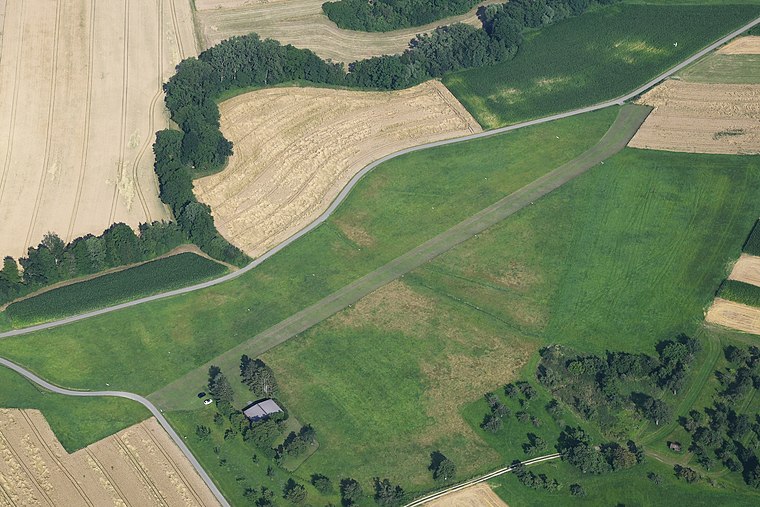
Photo: Carsten Steger, CC BY-SA 4.0.
Göppingen-Bezgenriet airfield is an aerodrome situated 3 km east of Pliensbach.
Stiftskirche St. Cyriakus
Church
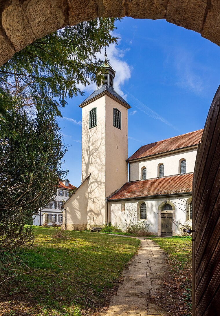
Photo: Aristeas, CC BY-SA 4.0.
Stiftskirche St. Cyriakus is a church situated 2½ km southeast of Pliensbach.
Localities in the Area
Aichelberg
Village
Aichelberg is a municipality in the district of Göppingen in Baden-Württemberg in southern Germany.
Bezgenriet
Village
Bezgenriet is the most southern district of Göppingen in Germany. Bezgenriet is situated 3 km northeast of Pliensbach.
Jebenhausen
Suburb
Photo: W. Bulach, CC BY-SA 4.0.
Jebenhausen is a suburb situated 5 km northeast of Pliensbach.
Pliensbach
- Type: Residential area
- Description: quarter of Zell unter Aichelberg, Baden-Württemberg, Germany
- Category: Ortsteil
- Location: Zell unter Aichelberg, Göppingen, Stuttgart, Baden-Württemberg, Germany, Central Europe, Europe
- View on OpenStreetMap
Latitude
48.6519° or 48° 39' 7" northLongitude
9.58566° or 9° 35' 8" eastElevation
377 metres (1,237 feet)Open Location Code
8FWFMH2P+Q7OpenStreetMap ID
way 52292635OpenStreetMap Feature
landuse=residentialGeoNames ID
2853198Wikidata ID
Q2099493Pliensbach Satellite Map
© OpenStreetMap, Mapbox and Maxar
Also Known As
- Afrikaans: Pliensbach
- Aragonese: Pliensbach
- Arpitan: Pliensbach
- Asturian: Pliensbach
- Basque: Pliensbach
- Bavarian: Pliensbach
- Breton: Pliensbach
- Catalan: Pliensbach
- Corsican: Pliensbach
- Croatian: Pliensbach
- Czech: Pliensbach
- Danish: Pliensbach
- Dutch: Pliensbach
- Esperanto: Pliensbach
- Estonian: Pliensbach
- Finnish: Pliensbach
- French: Pliensbach
- Friulian: Pliensbach
- Galician: Pliensbach
- German: Pliensbach
- Hungarian: Pliensbach
- Icelandic: Pliensbach
- Ido: Pliensbach
- Indonesian: Pliensbach
- Interlingua: Pliensbach
- Interlingue: Pliensbach
- Irish: Pliensbach
- Italian: Pliensbach
- Japanese: プリンスバッハ
- Kongo: Pliensbach
- Ligurian: Pliensbach
- Limburgan: Pliensbach
- Low German: Pliensbach
- Luxembourgish: Pliensbach
- Malagasy: Pliensbach
- Malay: Pliensbach
- Minangkabau: Pliensbach
- Narom: Pliensbach
- Neapolitan: Pliensbach
- Norwegian Bokmål: Pliensbach
- Norwegian Nynorsk: Pliensbach
- Occitan (post 1500): Pliensbach
- Picard: Pliensbach
- Piemontese: Pliensbach
- Polish: Pliensbach
- Portuguese: Pliensbach
- Romanian: Pliensbach
- Romansh: Pliensbach
- Russian: Плинсбах
- Sardinian: Pliensbach
- Scots: Pliensbach
- Scottish Gaelic: Pliensbach
- Serbian: Pliensbach
- Sicilian: Pliensbach
- Slovak: Pliensbach
- Slovenian: Pliensbach
- Spanish: Pliensbach
- Swahili: Pliensbach
- Swedish: Pliensbach
- Swiss German: Pliensbach
- Venetian: Pliensbach
- Vietnamese: Pliensbach
- Vlaams: Pliensbach
- Volapük: Pliensbach
- Walloon: Pliensbach
- Welsh: Pliensbach
- Wolof: Pliensbach
- Zulu: Pliensbach
Localities in the Area
- SehningenNeighborhood
- HattenhofenVillage
- EckwäldenVillage
- HerdwiesenLocality, 2½ km northeast
- SchopflenbergSuburb, 2½ km northeast
Places in the Area
- UhrturmTower
- Gasthaus SonneBuilding
- Letsch Ronald M.Doctor's office, 760 metres southwest
- Zell (u. A.) SchillerstraßeBus stop, 770 metres southwest
Popular Destinations in Baden-Württemberg
Discover Stuttgart, Heidelberg, Karlsruhe and Mannheim.
Escape to a Random Place
Discover other destinations in the world.
About Mapcarta. Thanks to Mapbox for providing amazing maps. Data © OpenStreetMap contributors and available under the Open Database License. Text is available under the CC BY-SA 4.0 license, excluding photos, directions and the map. Photo: Traveler100, CC BY-SA 3.0.