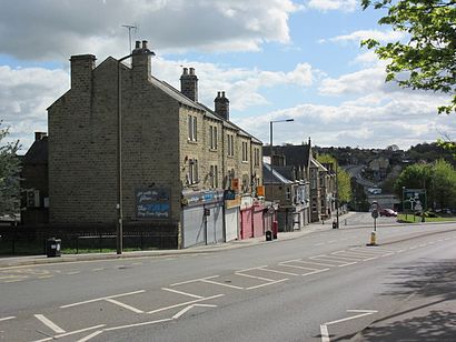
See Stairfoot, Barnsley, on the map
Directions to Stairfoot (Barnsley) with public transport
The following transport lines have routes that pass near Stairfoot
Bus:
Train:
How to get to Stairfoot by Bus?
Click on the Bus route to see step by step directions with maps, line arrival times and updated time schedules.
How to get to Stairfoot by Train?
Click on the Train route to see step by step directions with maps, line arrival times and updated time schedules.
Bus stations near Stairfoot in Barnsley
- Neville Avenue/Ash Grove,4 min walk,
- Hunningley Lane/Hunningley Close,4 min walk,
- Wombwell Lane/Bleachcroft Way,4 min walk,
- Doncaster Road/Hill Street,7 min walk,
Bus lines to Stairfoot in Barnsley
- 6,Worsbrough Dale,
- 7,Barnsley Town Centre,
- 481,Kendray,
- 22X,Rotherham Town Centre,
- 226,Wath upon Dearne,
- X19,Doncaster - Barnsley,
- 218,Conisbrough - Rotherham,
- 218A,Barnsley - Rotherham,
- 219,Doncaster - Barnsley,
- 219A,Barnsley,
- X20,Barnsley Town Centre,
What are the nearest stations to Stairfoot?
The nearest stations to Stairfoot are:
- Neville Avenue/Ash Grove is 237 meters away, 4 min walk.
- Hunningley Lane/Hunningley Close is 258 meters away, 4 min walk.
- Wombwell Lane/Bleachcroft Way is 279 meters away, 4 min walk.
- Doncaster Road/Hill Street is 464 meters away, 7 min walk.
Which Bus lines stop near Stairfoot?
These Bus lines stop near Stairfoot: 219, 226, 22X
Which Train lines stop near Stairfoot?
These Train lines stop near Stairfoot: NORTHERN
What’s the nearest bus stop to Stairfoot in Barnsley?
The nearest bus stops to Stairfoot in Barnsley are Neville Avenue/Ash Grove, Hunningley Lane/Hunningley Close and Wombwell Lane/Bleachcroft Way. The closest one is a 4 min walk away.
What time is the first Bus to Stairfoot in Barnsley?
The 22X is the first Bus that goes to Stairfoot in Barnsley. It stops nearby at 05:07.
What time is the last Bus to Stairfoot in Barnsley?
The 226 is the last Bus that goes to Stairfoot in Barnsley. It stops nearby at 23:44.
How much is the Train fare to Stairfoot?
The Train fare to Stairfoot costs about £3.20 - £13.10.
See Stairfoot, Barnsley, on the map

Public Transit to Stairfoot in Barnsley
Wondering how to get to Stairfoot in Barnsley, United Kingdom? Moovit helps you find the best way to get to Stairfoot with step-by-step directions from the nearest public transit station.
Moovit provides free maps and live directions to help you navigate through your city. View schedules, routes, timetables, and find out how long does it take to get to Stairfoot in real time.
Looking for the nearest stop or station to Stairfoot? Check out this list of stops closest to your destination: Neville Avenue/Ash Grove; Hunningley Lane/Hunningley Close; Wombwell Lane/Bleachcroft Way; Doncaster Road/Hill Street.
Bus:Train:
Want to see if there’s another route that gets you there at an earlier time? Moovit helps you find alternative routes or times. Get directions from and directions to Stairfoot easily from the Moovit App or Website.
We make riding to Stairfoot easy, which is why over 1.5 million users, including users in Barnsley, trust Moovit as the best app for public transit. You don’t need to download an individual bus app or train app, Moovit is your all-in-one transit app that helps you find the best bus time or train time available.
For information on prices of Bus, Train and Light rail, costs and ride fares to Stairfoot, please check the Moovit app.
Use the app to navigate to popular places including to the airport, hospital, stadium, grocery store, mall, coffee shop, school, college, and university.
Stairfoot Address: Hunningley Lane street in Barnsley

Attractions near Stairfoot
- Exclusive Building Developments
- Gee Vee Travel
- Tasker's Tyres
- Stairfoot roundabout
- BFS Cash & Carry Barnsley
- Dustbunnies Domestic & Commercial Cleaning Company
- Cool Cuts Group
- August Roots Healthcare
- Gold Leaf
- ALDI
- Amazon Counter-Post Office Stairfoot
- B&Q
- Stairfoot Business Park (B & Q)
- Travelodge Barnsley
- Tradepoint
- Daisydrift
- Zaza Demir
- Amazon Counter-Morrisons Daily
- Barnsley
- Ezenwa Care
How to get to popular attractions in Barnsley with public transportation
- Robin Hood Airport (DSA), Finningley
- Moor Allerton, Leeds
- Skipton, Skipton
- David Lloyd York, York
- Cottingley Towers, Leeds
- Kirkstall Abbey (Ruins), Leeds
- Darnall, Sheffield
- Doncaster Sheffield International Airport, Finningley
- University Of Sheffield Students' Union, Sheffield
- Copley Data Centre, Halifax
- Castle Hill Hospital, Cottingham
- The 72 Bus - Bradford To Leeds, Leeds
- B&Q Doncaster Distribution Centre (Redhouse), Brodsworth
- Cathedral Tram Stop, Sheffield
- Graves Park, Sheffield
- Elland Road Stadium, Leeds
- Endcliffe Park, Sheffield
- Crown Point Shopping Park, Leeds
- Quarry House, Leeds
- Arundel Gate Mini Interchange, Sheffield