
Euphrates Syria Pictures, Images and Stock Photos
Browse 160+ euphrates syria stock photos and images available, or start a new search to explore more stock photos and images.
Most popular
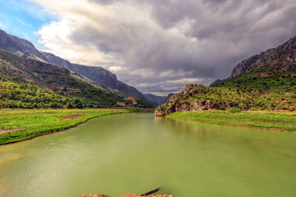
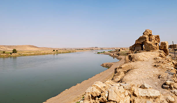
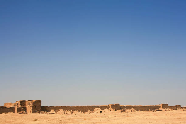
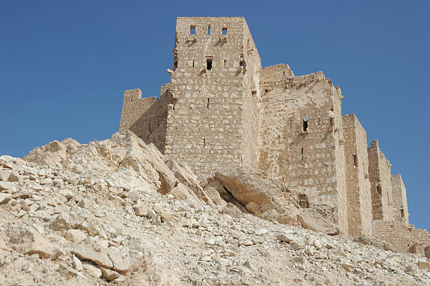
Looking at the Euphrates River through the ruins of Halabiye Fortress in Syria, founded by Queen Zenobia in the 3rd century AD.
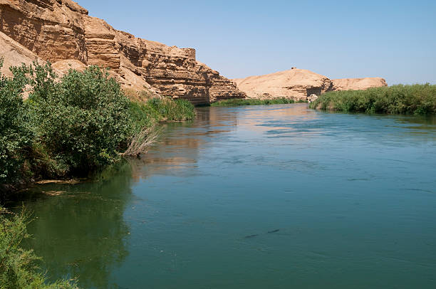
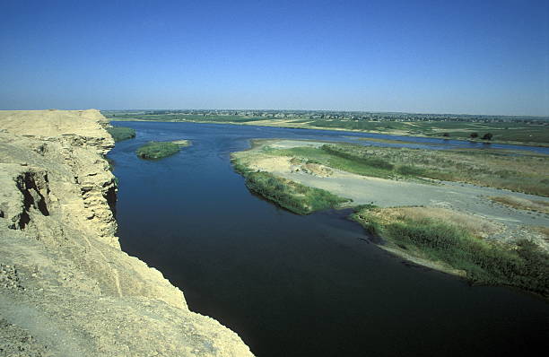
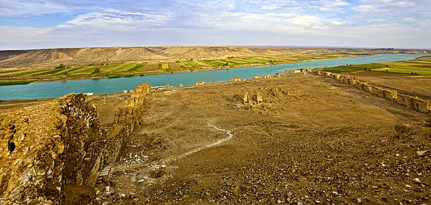
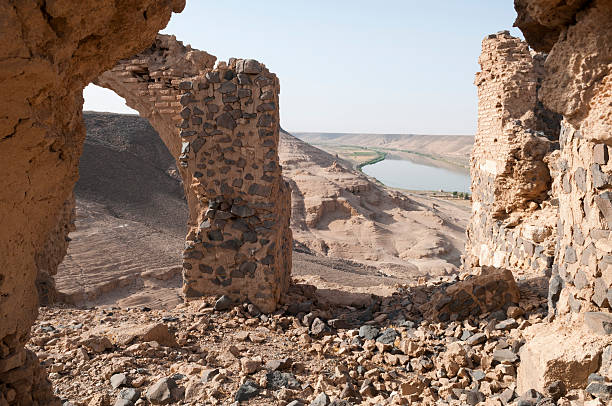
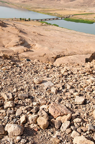
The Euphrates river near Dura Europos (Tell Salhiye), Syria. Iraq is just several miles downstream.
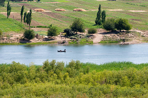
Fishermen work from a boat on the Euphrates river near Dura Europos (Tell Salhiye), Syria, just a few miles north of where the river flows into Iraq. The region is barren desert, except for the irrigated fields along the banks of the river.
Aleppo, Syria - October 1, 2008: Syria before the war. People on the bridge over the Euphrates river at sunset in Deir ez-Zor in Eastern Syria. During the ongoing Syrian civil war Deir ez-Zor was under siege by ISIL during two years.
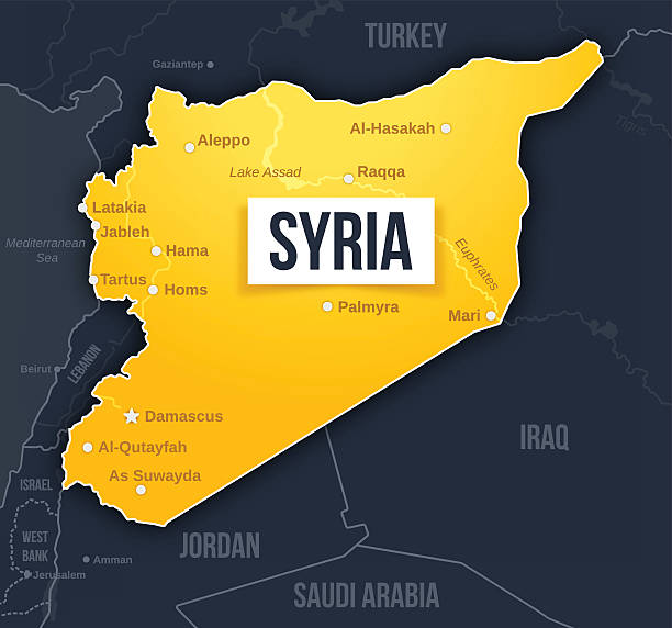
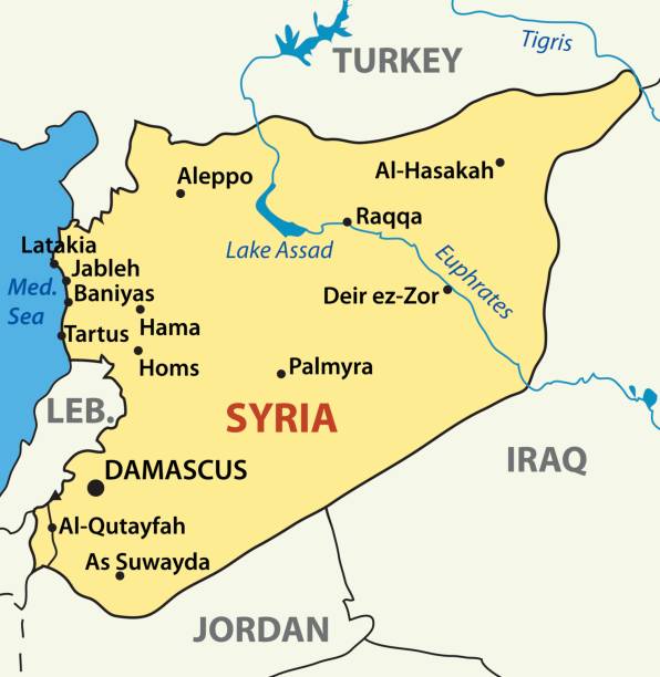
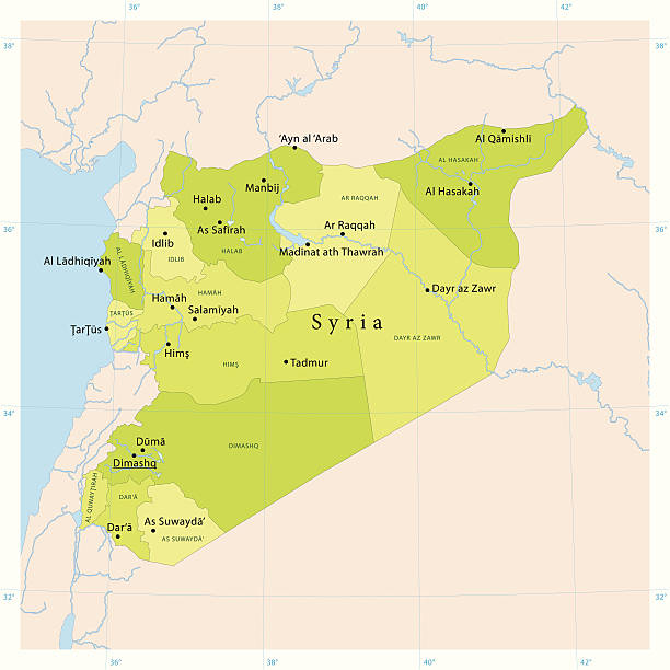
Syria map concept with major cities, waterways and country borders. EPS 10 file. Transparency effects used on highlight elements.
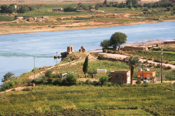
Syria before the war. The cultivated banks of the Euphrates river, next to the archeological remains of the ancient Hellenistic and Roman border city of Dura Europos, near Deir ez-Zor, in eastern Syria. Dura Eoropos suffered many wars and conquests and was finally abandoned in 257 AD. It has been further looted and destroyed during the Syrian civil war that started in 2011.
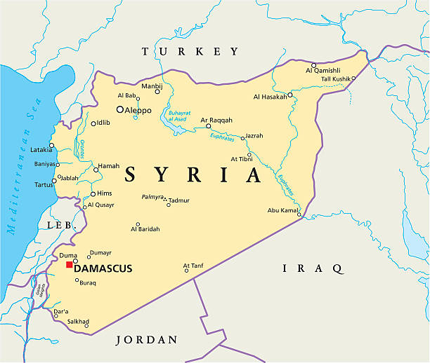
Political map of Syria with capital Damascus, national borders, most important cities, rivers and lakes. Vector illustration.
Aleppo, Syria - October 1, 2008: Syria before the war. People on the bridge over the Euphrates river at sunset in Deir ez-Zor in Eastern Syria. During the ongoing Syrian civil war Deir ez-Zor was under siege by ISIL during two years.
Euphrates River, which is located northeast of the Syrian city of Aleppo on the Syrian-Turkish border and is characterized by its fresh water, which drink most of the population of Syria
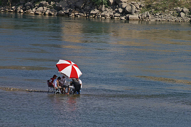
Raqqa, Syria - 7th May, 2010: some people sitting on chairs under an umbrella in the river Euphrate near Raqqa in Syria.
The Euphrates river at Dura Europos (Tell Salhiye), Syria. Some of the remains of this ancient frontier outpost are visible on the left, and a boat of fishermen is in the upper part of the river. Iraq is just several miles downstream.
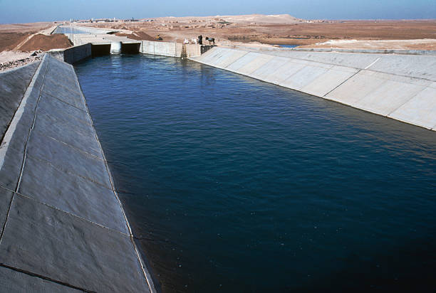
An irrigation canal drawing water from the Euphrates River in northeastern Syria
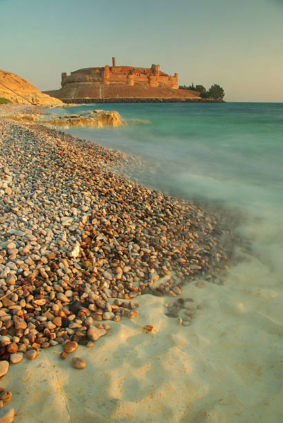
sunset light on Qalaat Jabaar castle on the shores of lake Al Assad in northern Syria
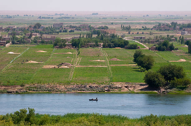
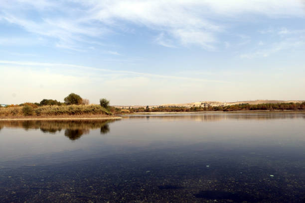
The Euphrates river and farmland seen from Dura Europos, Syria, just a few miles north of where the river flows into Iraq
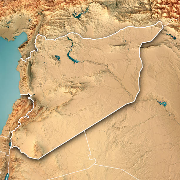
3D Render of a Topographic Map of Syria, Middle East. All source data is in the public domain. Color texture: Made with Natural Earth. http://www.naturalearthdata.com/downloads/10m-raster-data/10m-cross-blend-hypso/ Boundaries Level 0: Humanitarian Information Unit HIU, U.S. Department of State (database: LSIB) http://geonode.state.gov/layers/geonode%3ALSIB7a_Gen Relief texture and Rivers: SRTM data courtesy of USGS. URL of source image: https://e4ftl01.cr.usgs.gov//MODV6_Dal_D/SRTM/SRTMGL1.003/2000.02.11/ Water texture: SRTM Water Body SWDB: https://dds.cr.usgs.gov/srtm/version2_1/SWBD/
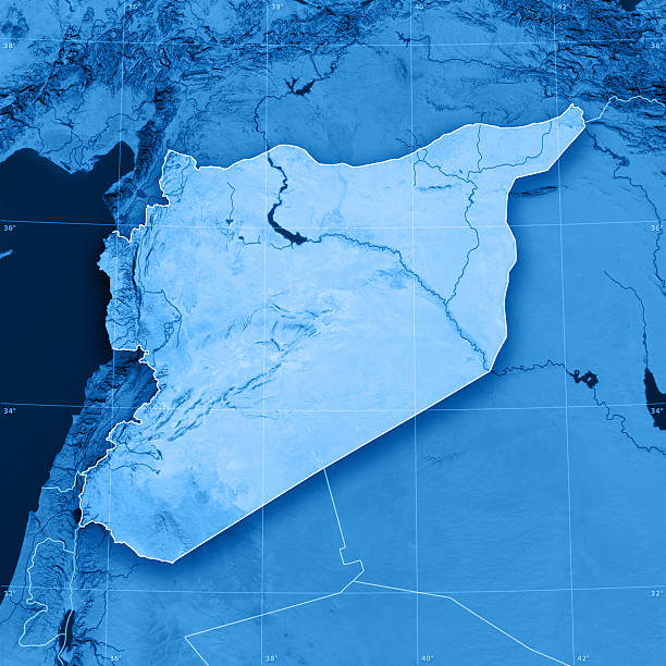
3D render and image composing: Topographic Map of the Syrian Arab Republic. Including country borders, rivers and accurate longitude/latitude lines. High quality relief structure!
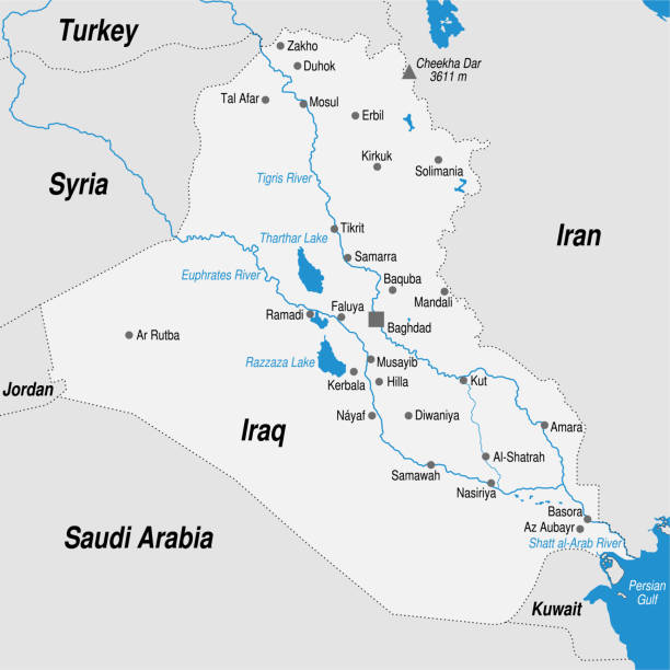
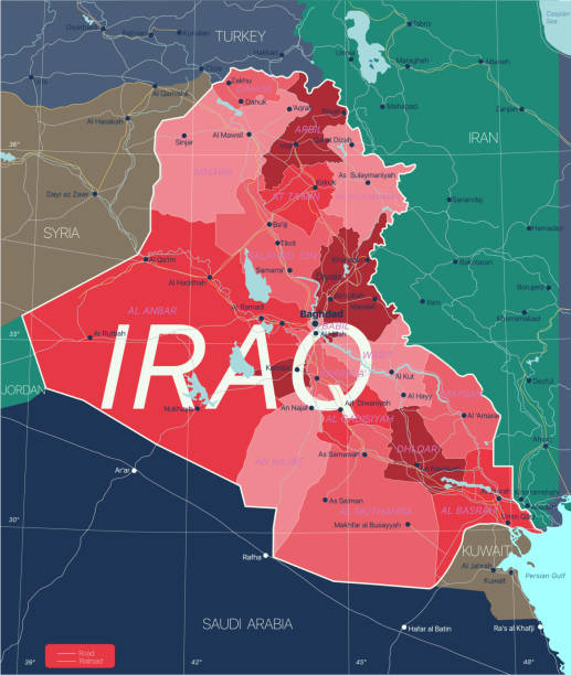
Political map of the Republic of Iraq with the most important cities marked in gray and blue tones. Vector image
the euphrates river near the city of Deir ez zur in the east of Syria in the middle east
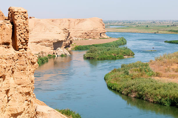
The Euphrates River in Halabiye, Syria. On the bank is a tree, an irrigation pump leading up from the river, buildings, and cows.
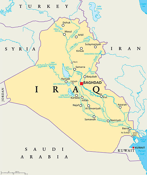
Iraq political map with capital Baghdad, national borders, important cities, rivers and lakes. Also called Mesopotamia, the land between Tigris and Euphrates. English labeling. Illustration.
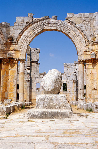
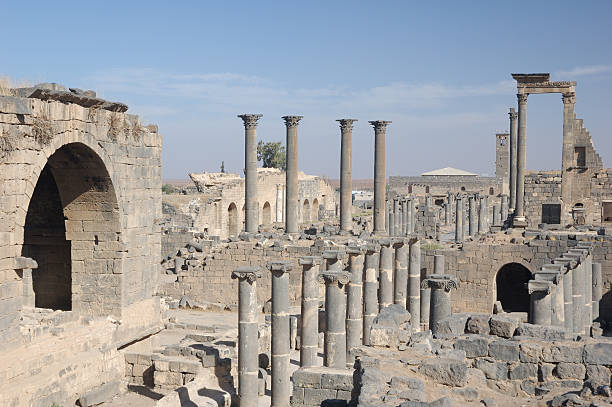
Ruins of the Byzantine Saint Simeon the Stylite Abbey, near Aleppo, Syria.
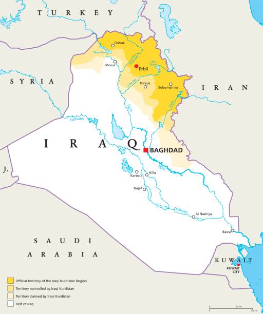
Iraqi Kurdistan Region political map. Official, controlled and claimed territories in Iraq. Neighbor countries, capitals and important cities, rivers and lakes. English labeling. Illustration. Vector.
Administrative Map of Iraq Vintage Color with capital Baghdad, national borders, important cities, rivers and lakes.
The Tabqa Dam is an earth-fill dam on the Euphrates, located 40 kilometres (25 mi) upstream from the city of Ar-Raqqah in Ar-Raqqah Governorate, Syria. The dam is 60 metres (200 ft) high and 4.5 kilometres (2.8 mi) long and is the largest dam in Syria. Its construction led to the creation of Lake Assad, Syria's largest water reservoir. The dam was constructed between 1968 and 1973 with help from the Soviet Union.
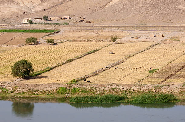
Farmers' fields on the banks of the Euphrates River in Halabiye, Syria. A flock of sheep are in the field.
Syria before the war. The archeological remains of the ancient Hellenistic and Roman border city of Dura Europos on the banks of river Euphrates, near Deir ez-Zor, in eastern Syria. Dura Eoropos suffered many wars and conquests and was finally abandoned in 257 AD. It has been further looted and destroyed during the Syrian civil war that started in 2011.
Iraq Road Map and map icons with capital Baghdad, national borders, important cities, roads, highways, railroads, rivers and lakes.
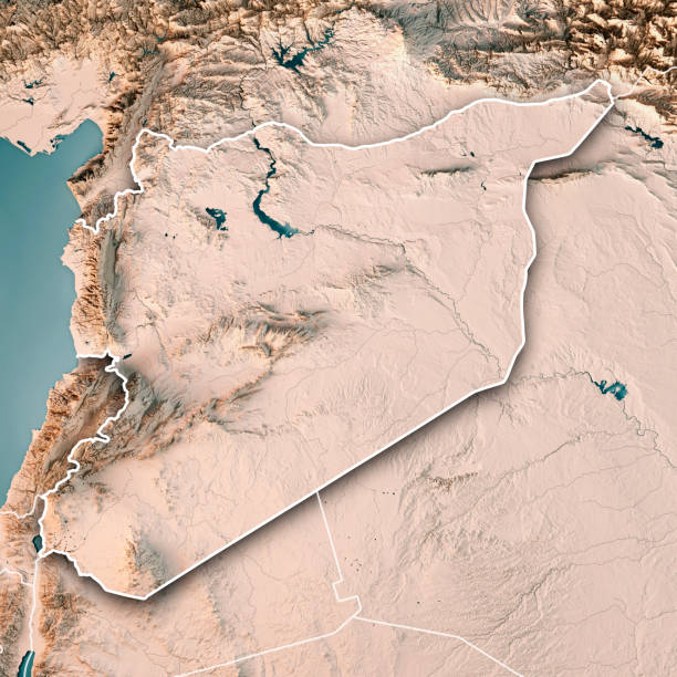
3D Render of a Topographic Map of Syria, Middle East. All source data is in the public domain. Boundaries Level 0: Humanitarian Information Unit HIU, U.S. Department of State (database: LSIB) http://geonode.state.gov/layers/geonode%3ALSIB7a_Gen Relief texture and Rivers: SRTM data courtesy of USGS. URL of source image: https://e4ftl01.cr.usgs.gov//MODV6_Dal_D/SRTM/SRTMGL1.003/2000.02.11/ Water texture: SRTM Water Body SWDB: https://dds.cr.usgs.gov/srtm/version2_1/SWBD/
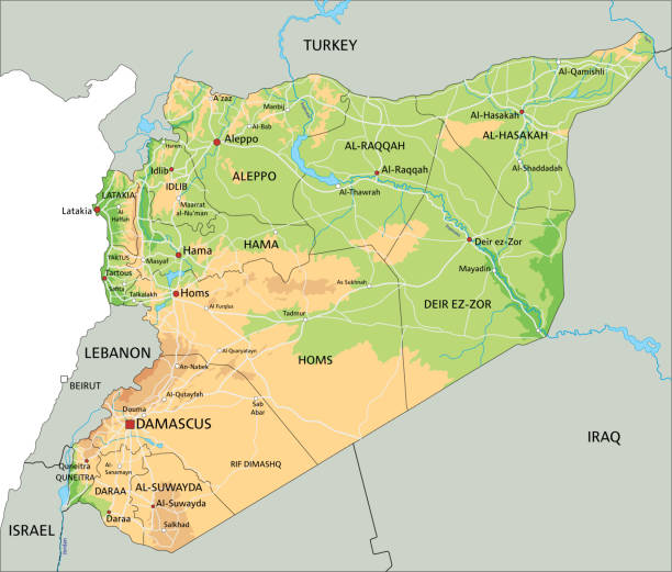
High detailed Syria physical map with labelling. Organized vector illustration on seprated layers.
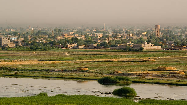
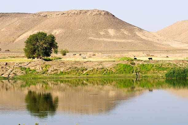
Fertile irrigated landscape following Euphrates river, Dura Europos, east Syria

The Euphrates River between Aleppo and the border zom Iraq on the Euphrates River in the north of Syria in the Middle East.
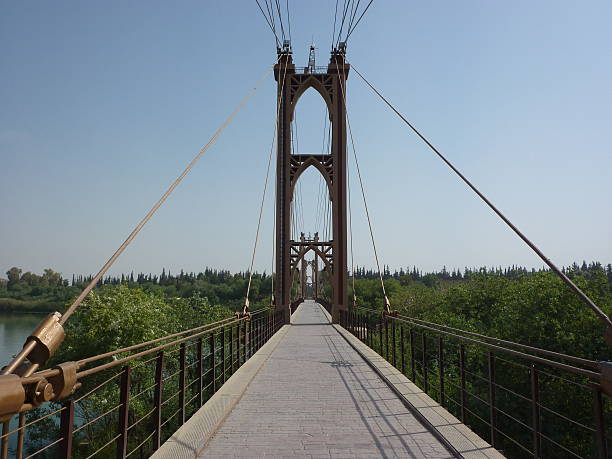
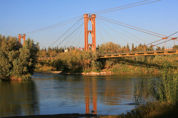
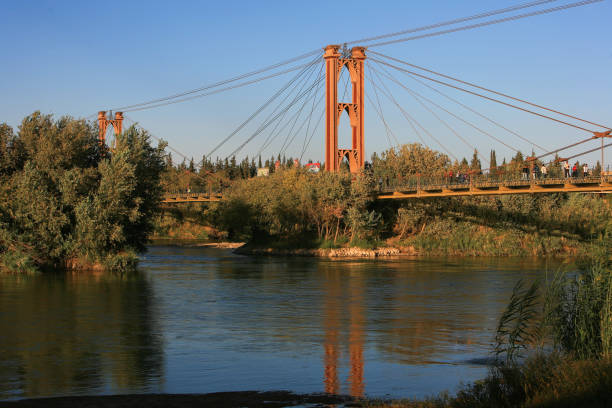
Syria - Deir ez-Zor - Mesopotamia - Suspension bridge on the Euphrates - The city of Bedouins (6.5.2010)
Syria before the war. The archeological remains of the ancient Hellenistic and Roman border city of Dura Europos on the banks of river Euphrates, near Deir ez-Zor, in eastern Syria. Dura Eoropos suffered many wars and conquests and was finally abandoned in 257 AD. It has been further looted and destroyed during the Syrian civil war that started in 2011.
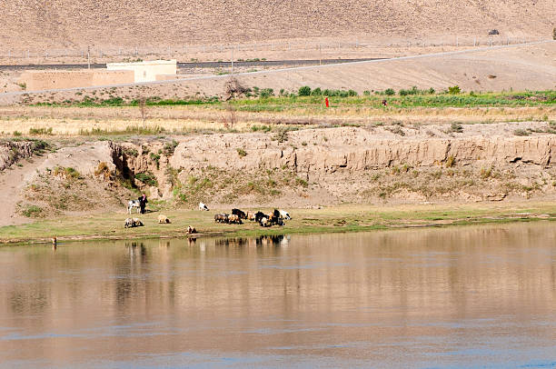
An Arab man shepherds his flock of sheep or goats beside the Euphrates River in Syria. On the bank above two women tend a field.
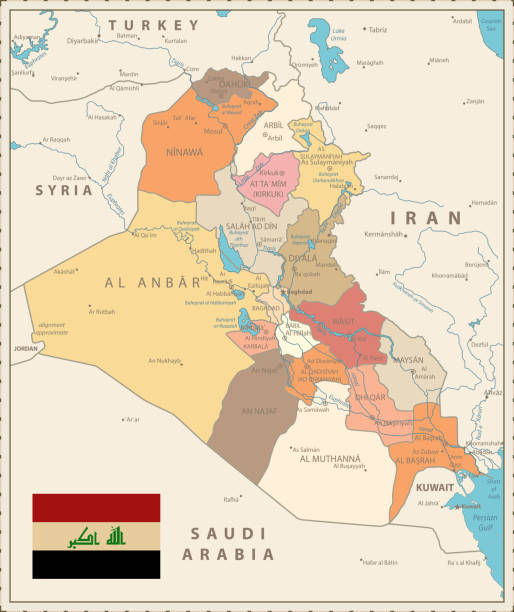
Irak country detailed editable map with regions cities and towns, roads and railways, geographic sites. Vector EPS-10 file
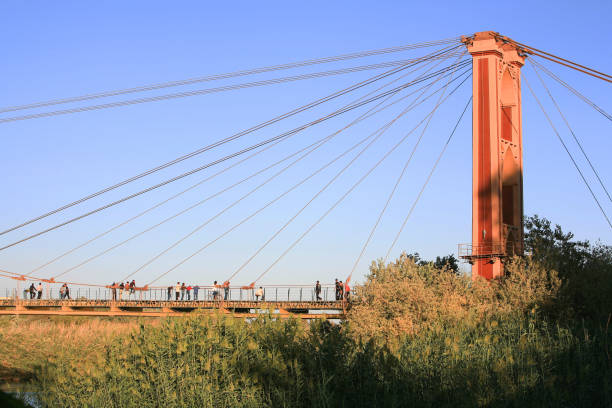
Aleppo, Syria - October 1, 2008: Syria before the war. People on the bridge over the Euphrates river at sunset in Deir ez-Zor in Eastern Syria. During the ongoing Syrian civil war Deir ez-Zor was under siege by ISIL during two years.
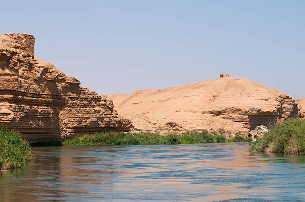
The Euphrates river at Dura Europos, Syria
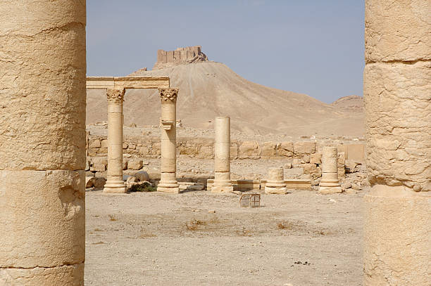
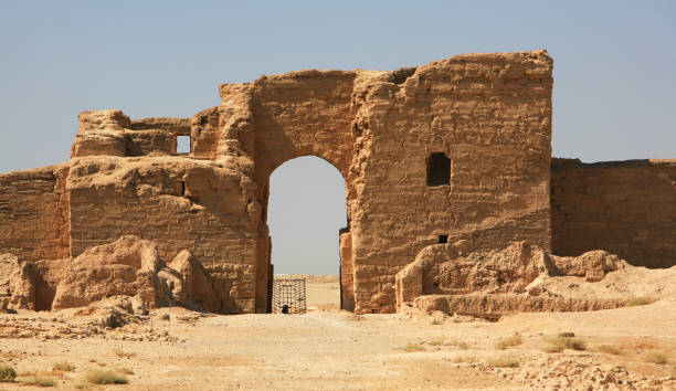
City of Palmyra - ruins of the 2nd century AD
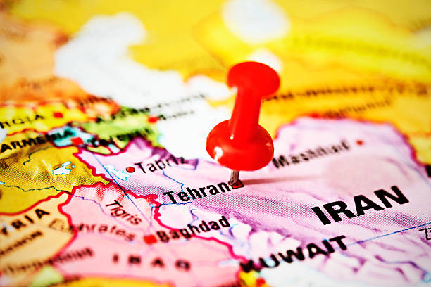
A red pushpin is stuck into Tehran on a map of part of the Middle East.
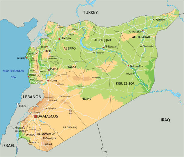
High detailed Syria physical map with labelling. Organized vector illustration on seprated layers.
Studying Geography - Syria on retro globe.
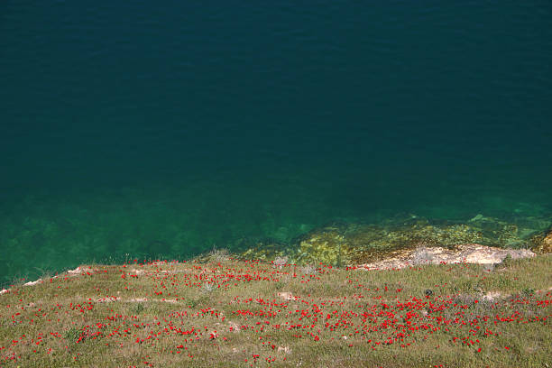
View of the Euphrates River through the ruins of Halabiye Fortress in Syria. The fortress was founded by Queen Zenobia in the 3rd century AD.
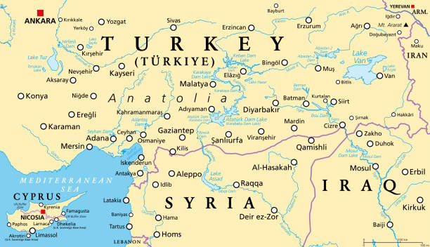
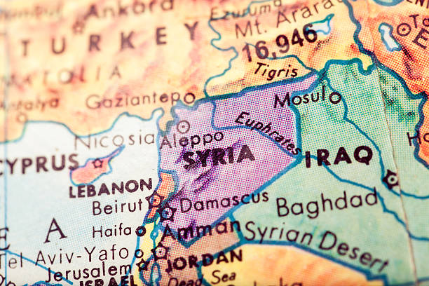
Part of the Turkish peninsula of Anatolia, political map, with Cyprus and northern Syria and Iraq. Eastern and Southeastern Anatolia, and Mediterranean Region. Geographical regions of Turkey, Türkiye.
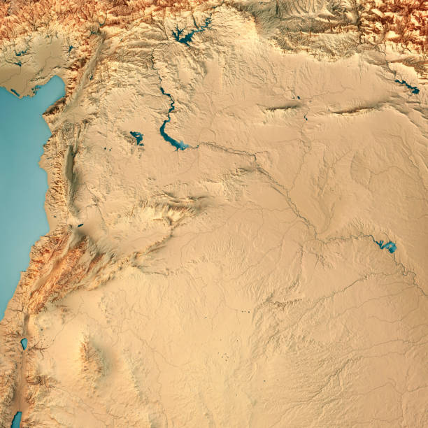
3D Render of a Topographic Map of Syria, Middle East. All source data is in the public domain. Color texture: Made with Natural Earth. http://www.naturalearthdata.com/downloads/10m-raster-data/10m-cross-blend-hypso/ Relief texture and Rivers: SRTM data courtesy of USGS. URL of source image: https://e4ftl01.cr.usgs.gov//MODV6_Dal_D/SRTM/SRTMGL1.003/2000.02.11/ Water texture: SRTM Water Body SWDB: https://dds.cr.usgs.gov/srtm/version2_1/SWBD/
A road that leads to India. Aleppo, Syria
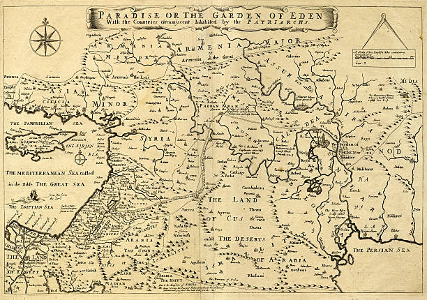
This may appear to be a straightforward map of the Middle East. However, closer inspection will reveal some extraordinary details, a number of descriptions on the map refer to stories from the Bible.
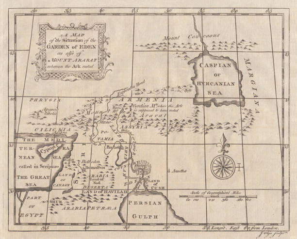
A Map of the Situation of the Garden of Eden as also of Mount Ararat whereon the Ark rested. Copperplate engraving, published in 1774.
The view from atop the ruins of the Halabiye Fortress in Syria, founded by Queen Zenobia in the 3rd century AD. In the distance is a bridge over the Euphrates River.
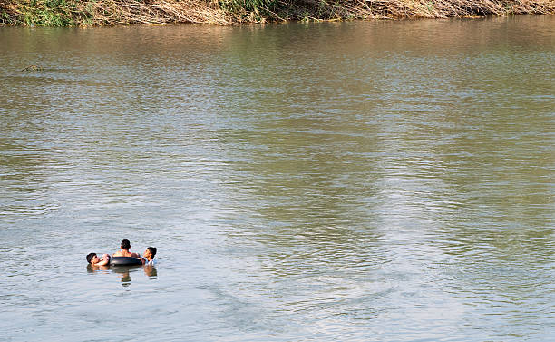
Deir ez-Zur, Syria - June 20, 2010: Three boys share an inner tube on the Euphrates River in Deir ez-Zur, Syria.
Bosra old city on the desert, Syria
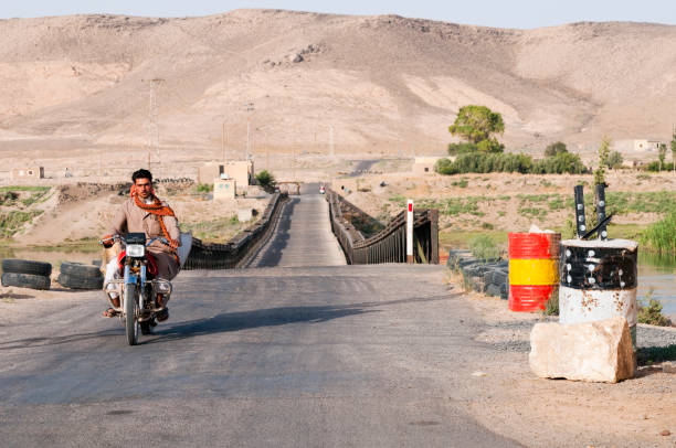
Halabiye, Syria - June 22, 2010: A woman sits behind a man as they travel by motorbike across a bridge on the Euphrates River. On the far side of the bridge a security officer closes the gate.
Iraq Map Spot Green Colors and glossy icons. Detailed vector illustration of map.
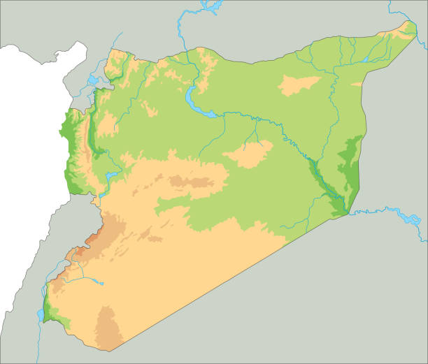
High detailed Syria physical map. Organized vector illustration on seprated layers.
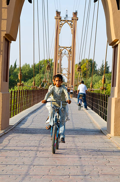
Deir ez-Zur, Syria - June 20, 2010: Two Syrian boys ride a bicycle over a suspension bridge built above the Euphrates River. The bridge was built by the French in 1927, and would be destroyed by shelling during the Syrian conflict in 2013. Other people are visible in the background crossing the bridge.
Palmyra city on the desert - Arab Castle on Hill (Qalat Ibn Maan)