The Reinebringen hike is undoubtedly the most famous hike on the Lofoten Islands in Norway – and it’s easy to see why. In the summer season, every day hundreds of visitors make their way up this mountain to witness the striking view from its summit.
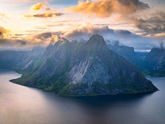
Hiking Reinebringen was at the top of my must-do list on my Northern Norway trip and now that I’ve done it, I can honestly say it’s worth every bit of the hype. The panoramic view of the jagged pointy mountains and the deep blue fjord is simply breathtaking. It’s definitely one of the most amazing hikes in Lofoten.
This blog post will delve into everything you need to know to hike Reinebringen, including the relevant stats about the trail, the best time to hike, how to avoid crowds, where to stay as well as a map of the trail.
Disclosure: This article contains affiliate links from which I may make a commission at no additional cost to you if you make a purchase.
General info about the Reinebringen hike
Type of hike: out-and-back
Distance: 2.8km (1.7 mi) round-trip
Difficulty: medium
Time: 2-2.5 hours in total
Altitude: 448m (1470 ft)
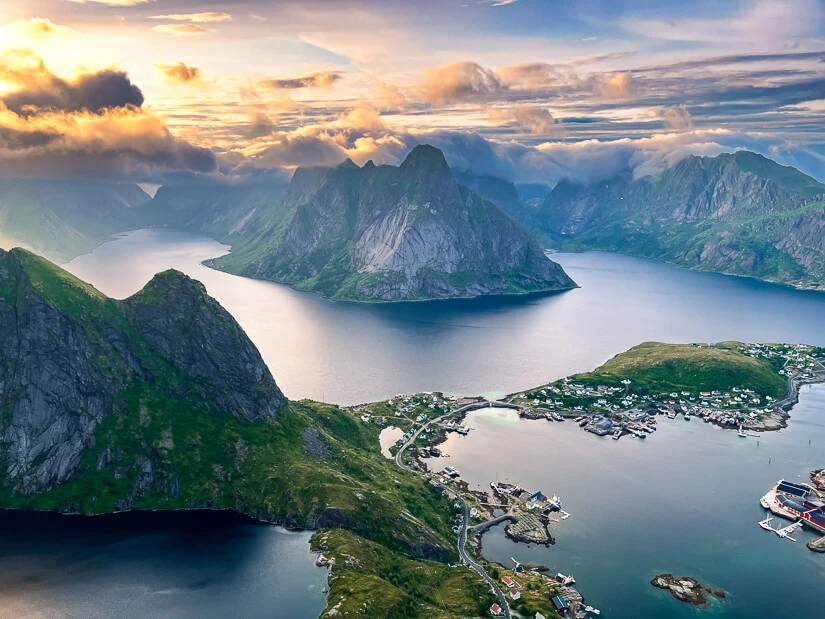
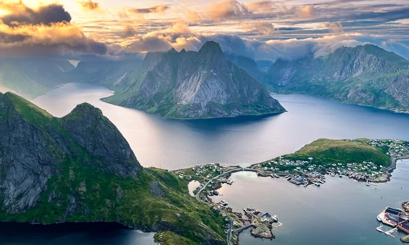
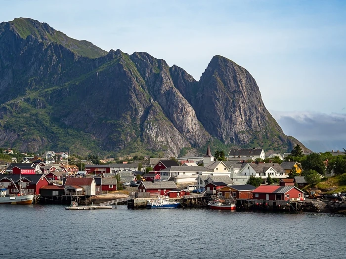
Reinebringen is located in Moskenes municipality, near Reine village. With a height of 448m (1470 ft), it’s nowhere close to being one of the tallest mountains in Lofoten but what it lacks in height, it surely makes up for with its view.
Because of the spectacular view, the relatively easy access and all the photos of this hike shared on social media, Reinebringen has become a highly popular destination on the Lofoten Islands. Despite the crowds, this hike simply has to be on your Lofoten itinerary. It’s popular for a reason!
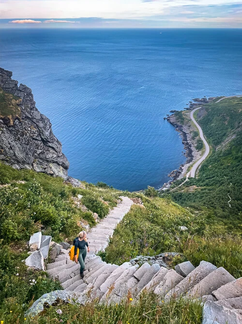
While the trail leading to its summit is short, it is very steep and has a stone stairway consisting of 1978 Sherpa steps. This stairway was built over the years 2016-2021 by Nepalese Sherpas hired by the local municipality. The reason for building the stairs was to make it safer for the large number of visitors to hike Reinebringen and to protect the ground from erosion.
Before the construction of the stairs, the Reinebringen trail was a slippery muddy mess with frequent rockfalls that sometimes caused injuries and even deaths to hikers. It was even considered one of Norway’s most dangerous tourist destinations. Thankfully, these days are over and the stairs make it a lot safer and more convenient to do this hike.
How to hike Reinebringen
Parking
Parking options near the Reinebringen hike are quite limited and due to the large number of tourists in the summer, this can sometimes be problematic. Although parking alongside the road is prohibited, you’ll still see people doing this. Don’t be one of them.
Here are three places you can park to do the hike:
- Djupfjord parking lot – Located 1.3km (0.8 mi) south of the trailhead along the E10 road, close to Djupfjord bridge. In Google Maps, this place is called ‘Steffenakken’. Parking is free of charge.
- Reine outer harbor – Located in Reine, 1.8km (1.1 mi) from the trailhead. 40 NOK/hour.
- Reine Kultursenter – Located in Reine, 1.5km (0.9 mi) from the trailhead. 150 NOK/day.
You can find the exact locations of these car parks on the map further below.
The trail
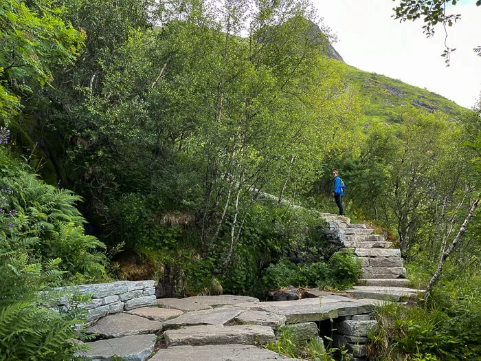
Reinebringen trailhead is located close to the southern end of the Ramsvik tunnel, on the old road alongside the tunnel. This is where you’ll start climbing the 1978 steps until you reach the summit.
It’s impossible to get lost as the trail is very easy to follow. It takes about one hour to get to the peak. In order to protect the vulnerable vegetation on the mountain, do not step off the trail.
Along the way, there are stone benches where you can take a break and rest your legs if you need it. Although the steep and continuous ascent is quite demanding, with enough breaks and a slow pace almost anyone can do it.
The summit
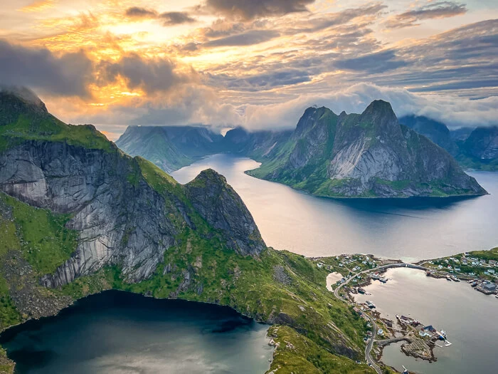
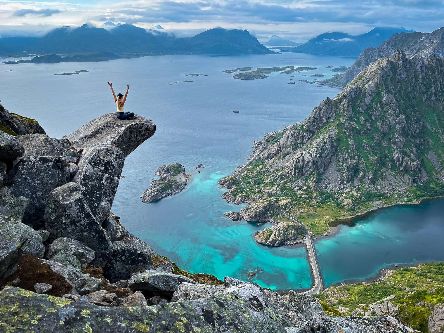
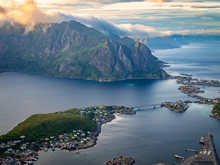
Once you reach the summit ridge of Reinebringen, you can continue walking both to the right and left side along the ridge to reach a few different viewpoints.
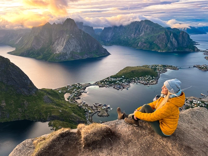
The panoramic views from the top are absolutely stunning and worth all the effort to get there. From here, you can see the beautiful Reinefjord and Kjerkfjord surrounded by majestic mountains and the villages of Reine, Sakrisøy and Hamnøy. The raw natural beauty of these coastal arctic landscapes really left me speechless.
Be cautious when walking near the ridge and don’t go too close to the edge because there’s a straight vertical drop on one side of the ridge.
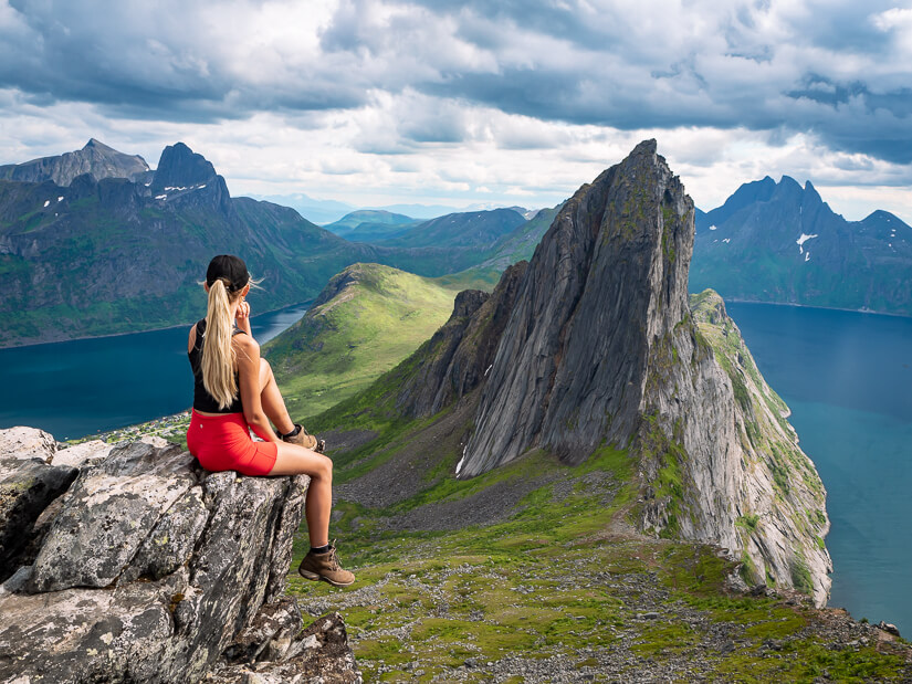
RELATED POST: Looking to add more scenic hikes to your itinerary? Then check out my blog post on the 10 best hikes in Lofoten.
Best time to do this hike
The best time of the year for hiking Reinebringen is from mid-May to the end of September. The hike is strictly not recommended in the winter due to safety reasons. Not only do the steps get icy and slippery but there’s also a very high risk of avalanches and rockfall in the winter.
It can also be possible to hike Reinebringen in April and October if the weather conditions are right. For the most up-to-date information about the conditions of the trail, visit the Reinebringen Facebook page. For avalanche forecasts, check varsom.no.
July and August are the best months in terms of weather but they are also the busiest. If you plan to visit Lofoten in these months, I recommend doing the hike very early in the morning or later in the evening. Otherwise, the trail will be packed with hikers, you’ll need to wait in queues and you’ll barely have any space at the summit.
Reinebringen is also a fantastic place for watching the Midnight Sun, which occurs approximately between May 27 and July 17. We did the hike around 10pm in July and it couldn’t have been a better time. Not only did we get to see the beautiful golden rays of the Midnight Sun from the summit but we also had the place almost entirely to ourselves.
For a chance to see the Northern Lights at Reinebringen before the snow covers the trail, do the hike in September or October.
Regardless of which month you hike this trail, aim for a day with good visibility and no rain. Otherwise the steps can get slippery and the view might be covered by clouds.
Practical tips for hiking Reinebringen
- Be prepared for unpredictable weather. On the Lofoten Islands, weather conditions often change rapidly, even in the summer. One moment it’s sunny and the next it’s pouring rain. The most accurate weather forecast can be found at Yr.no.
- Bring lots of layers that you can put on or remove when needed and also a rainproof jacket. The temperature on the top of the mountain is usually colder than down at the trailhead.
- If you tend to get pain in your knees, bring trekking poles. Some people have said that the steep ascent and descent were hard on their knees.
- Don’t bring small children to the Reinebringen hike. The local municipality warns against it because there’s a risk of falling over the edge at the summit.
- If you have a fear of heights, this hike is probably not a good option for you.
- Remember to pack enough drinking water and a phone with sufficient battery.
- Camping on Reinebringen is prohibited. However, you are allowed to camp in the surrounding mountains as long as you follow the rules of Allemannsretten (the Norwegian right to roam).
Reinebringen hike map
On the interactive map below, I’ve marked the exact location of the Reinebringen hiking trail and the different parking lots near the trailhead. Click on the top left corner of the map for more details.
Where to stay near Reinebringen
We traveled around Lofoten by campervan and spent the night at the Djupfjord parking lot after hiking Reinebringen. However, if you’re looking for hotels to stay nearby, here are my recommendations:
MID-RANGE: Sakrisøy Gjestegård
This is a beautifully renovated manor house dating back to 1880. Almost all of their rooms have a sea view. There’s a garden and also a shared kitchen that guests can use.
MID-RANGE: The Tide
If you’d rather stay in a modern hotel with a fine-dining restaurant, this one is a great option. It’s about a 10-minute drive from Reine.
LUXURY: Reine Rorbuer
For a truly unique experience in Lofoten, stay at one of the rorbu-huts, which are traditional fishermen’s houses converted into cozy cabins.
In case you have any questions about the Reinebringen hike, let me know in the comments and I’ll do my best to answer them.
Be sure to also read my other Norway travel guides for more useful tips and inspiration for planning your trip:
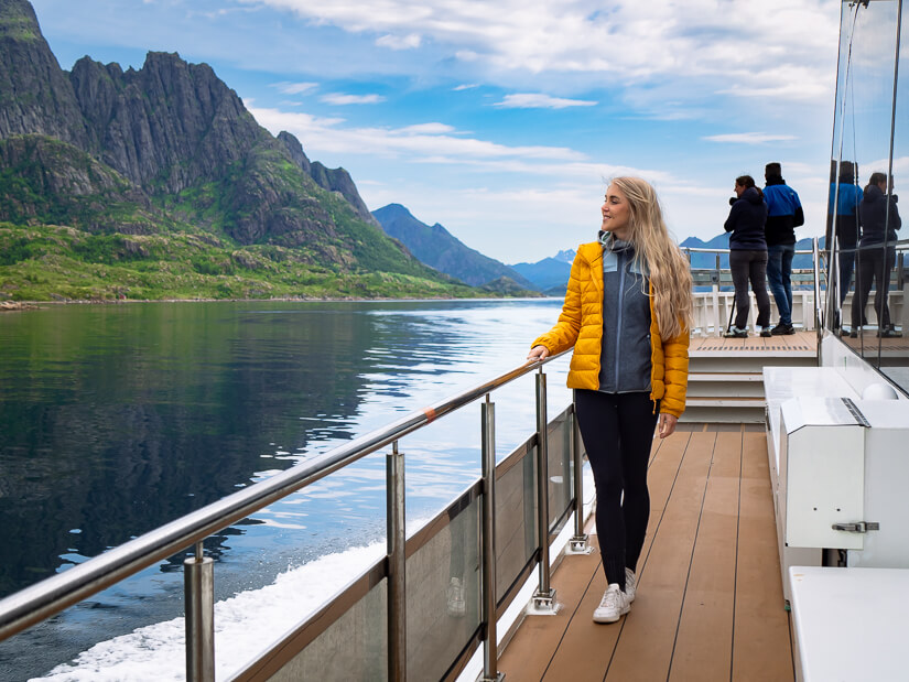
- Silent Trollfjord cruise in Lofoten
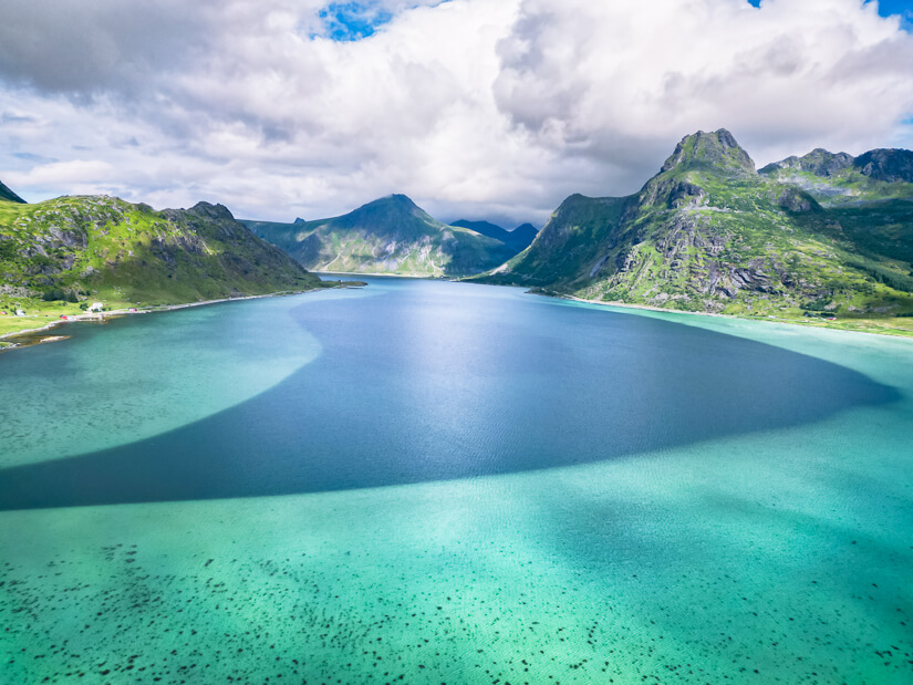
- Best beaches to visit on the Lofoten Islands
- 5 days in Lofoten: The perfect itinerary
- Tips for taking a campervan trip in Norway
- 10 most beautiful hiking trails in Lofoten
- Ethical whale watching in Tromso
Enjoyed reading about hiking Reinebringen? Pin it!
READ MORE: